August 29, 2016

Creative Lodging

This week's adventures put us in Cleveland, Pittsburgh, Kane (Pennsylvania), and a tiny town in upstate New York near Rochester to visit friends.

Mileage on my feet was a very respectable 38+, although there were no real long strings of continuous miles of running and only one big 10 mile hike.  The heat and humidity inserted walk breaks into even my short (and medium) runs. 

The first real lodging surprise of the trip? The Hyatt Regency Cleveland.  The Hyatt bought this historic victorian building, which was apparently not in use, and modified the 2nd and third story empty retail spaces into lodging.  It's absolutely beautiful and the rooms are very unique, with huge high ceilings and molding, plus an anteroom with a separate door before you enter the sleeping quarters with the bathroom.  Using points and cash, the nightly fee was $55+tax, which was definitely the highest value room (in terms of luxury to cost) we've had on this trip (other than places we've managed to stay for free, of course).

The Hyatt Regency Cleveland

View of Pittsburgh from Mt. Washington

Kane, PA -- 2nd unexpected lodging location.
We wanted to do a 10ish mile hike in the Allegheny National Forest, so we called the visitors' center, asked for recommendations for hikes, and then asked for recommendations for lodging near the trailhead we selected.  They sent us to the delightfully charming Kane Manor Inn.


We were thrilled with the old home (under renovation, but our room was perfectly serviceable), the owner/manager was extremely friendly and helpful, and in general, it was in serious competition with the Hyatt in Cleveland (but hitting heavy on several different axes) for best value lodging at $69+taxes per night with full B&B breakfast included.

Allegheny National Forest, RimRock Loop Trail
The hike was just over ten miles including the out and back to the loop.  The best part about the trail was all of the various mushrooms.  The worst part was the spiders, spider webs, and bugs.  I had to remove my visor in a hurry when I saw a spider on it, just inches from my face.  I realized a mile or so later that in doing so, I'd tossed my sunglasses into the forest.  Oh, well, I replaced them with cheap tourist crap from today's stop at Niagra Falls.

Wacky Mushrooms.

And more.

Not sure if this is due to sun exposure, or just natural.

Lots of these ones everywhere.

Funky coral-shaped funghi.

A very red and orange mushroom.
When we left Kane, we headed to Kinzua Bridge State Park on our way to upstate New York.  If you ever get a chance to stop by, I highly recommend it.  It is shocking what an F-1 Tornado can do to a 600+ ft steel structure (they probably should have replaced the original iron bolts...).


New York, near Rochester, with friends who left the bay area several years ago was perhaps the most relaxed we've been this whole trip.  I got in a run to their house followed by a full day of hanging out by and in the pool with their kids while E&B did manual labor on a yard improvement project, followed by a walk with one of my favorite long lost friends, and a great dinner together before we said goodbye.

Nothing like quality time with friends you used to see often to remind you just how much you miss them and how lucky you were to have had them so close by and frequently in your life when you did.

August 22, 2016

Open Space

After lots of big wide open spaces, we arrived in the Windy City!
I've written in the past about the connection, for me, between physical space, temporal space, emotional space, and mental space.

And then there's taste-space -- fois gras chocolates for dessert at Roister.  OBSCENELY TOO MUCH.

But this last week was the best manifestation of these concepts I've ever experienced.

I've had so much free thought (and super-weird free-association dreams).  Hours upon gloriously silent hours in the car while sitting as a passenger through South Dakota, Iowa, Wisconsin, Illinois, Indiana, and tonight, Ohio.  5 new states for me (I only need 14 more to get a complete set!) and a world of internal musing and observation.

I'd never driven in to Illinois before!
Trucking is so important to the US economy.  Nothing like sitting in a vehicle on interstate mid-US freeways (or stopping at a rest stop, or chatting with motel workers whose families are supported by truckers) to drive that point home and cause you to think about how little we (city-dwellers) need to know or care about the infrastructure that makes our lives function on a day-to-day basis.
One of many random highway art installations.

Corn.  SO. MUCH. CORN.

The Memorial Union on the lake in Madison, WI.

The nature of friendship has been a big center of thought for me on this trip.  I feel E&I growing closer every day as we sit in silence for hours on end and share conversations and tidbits when we feel like it.  The level of intimacy and sharing is the maximum that introverts could have, and yet, it is predicated upon shared physical space and time.  Without the shared resources of place and time, we would not be as close.  Period.
Roister Fried Chicken.  Amazing.

I've also thought quite a bit about historical travel.  While I can keep in touch via cell phone, social media, etc, historically, those who had the souls of nomads (like me) had to choose to leave and abandon their loved ones in order to experience adventure.  This choice between (proximal) human connection and adventure actually still exists today, albeit in a more minor form.  The reality is, by taking the life route I've chosen, by making this trip, I've essentially become a bit (even more?) of an expat. There are very few people in the region I consider my "home" who have chosen a life like the one I've chosen this year.  I have selected distance from them, both in terms of physical distance and time, and also, emotional and mental distance.  Me and my obvious normative cohort have less and less in common every time I choose something that is not the norm for my region/demographic/gender/etc.  Much like those who chose to Go West back in the day, or those who leave their home countries for foreign adventure or just re-integration elsewhere, I find myself feeling like I have less and less in common with most of the people I used to think of as *my people*.
View up the Chicago River from Lake Michigan.

A long weekend in Chicago with family reminded me, yet again, that shared physical time/location really is one of the most important sources of human closeness.  I feel very blessed to have married into an extremely cool family.  3 days of walking (urban-hiking 8ish miles is exhausting!), eating, drinking and laughing with them reminds me that despite my unique choices, I still have people in my tribe who are close to me and with whom I can share important memories, we just have to seek each other out and make the effort to compromise on time/locations/logistics, ideally finding a solution that is realistically workable and psuedo-comfortable for all of us that meshes into a wonderfully awesome meld that wouldn't otherwise exist. 

And, on the obligatory workout report, mileage for last week with hiking, running, and walking/sight-seeing was a respectable 30.88 plus several workouts including upper body and core.

Missing the end of tomato season in California - BT.  

August 15, 2016

Northwestern Rural Bits

Hello from Custer State Park, South Dakota.

This Californian and my associated Southern-raised Californian transplant partner did not even know (and we were both surprised to learn) that there's an entire state park (and associated town, Custer, SD -- awesome Mexican food for the first time in three weeks at The Begging Burro) that celebrates Custer.  We'd both been raised to believe that he wasn't that great of a guy.  And yet, here we were.

Turns out, the park that bears his name is awesome.

The hike to Black Elk Peak (in the national forest, but starting in the state park -- we arrived a few days after the Harney Peak to Black Elk Peak renaming chaos) was a great one, and tacking on a route down trail 4 to Little Devil's Tower (state park) just in time to dodge the thunderstorm with hail was a great way to close out the hike.  Iron Mountain road was wonderful (best way to view Mt. Rushmore) and the Crazy Horse Memorial was totally worth it.

Best quote from the locals re: Harney/Black Elk Peak?

"We're so proud of our peak, it's the highest in the Northern Hemisphere east of the Rockies 'til France."

In general, all of the people we've met in the last several days have been so friendly and wonderful that I want to fall in love with this part of my country.

But on the other hand, there's the unnecessary use of K's.  Everywhere.  Like the Komfortable Kampgrounds. Or the Kopper Kettle Cafe.  And the complete and utter lack of racial diversity outside of service labor and theater. Oh, and did I mention the regular flying of confederate flags?  This is the the WEST, I want to stop and ask about history and symbolism and WHY every time I see a confederate flag on an ATV or 4X4 (But, in their defense, it's also shockingly common in rural NorCal, Oregon, and Washington -- if I stopped every time, we'd never get anywhere on this roadtrip).

It's been great hiking, not enough vegetables, too much lean red meat (elk, buffalo, etc.), good quiet sleep without light pollution, and lots of soul-searching...In other words, it's been wonderful.

But I'm ready to go East.

August 9, 2016

Alberta

We crossed the continental divide into Alberta sometime two Sundays ago.  We spent a week hiking in Jasper and Banff National Parks, racking up a total of 33 miles of hiking at elevation including more than 2 miles of vertical climb.

The landscape in Alberta is unlike anything I've ever seen.  Every road bend brings a new view.
Caribou stopping traffic on the highway.


Athabasca falls.

Just one of many ridiculous views from the drive.

Glacier melt with so much silt it looks like milk.

Glacier silt filling Lake Louise (glacial sand beach).
Hike up, Tram Down, take 2. (Sulphur Mountain, Banff)

Lake Louise.


August 6, 2016

Whistlers Peak (Jasper, AB) Hike Report

View of the Tramhouse from just before the trailhead.
The Jasper National Park brochure recommended this as a "Difficult" hike of 6.8 Km from the trailhead to the Jasper SkyTram.  Several other posts indicated it was 6.8 Km to the actual Summit, but the trail from the Tram to the Summit was listed as 1.4 Km.  Estimated hiking times ranged from 3-6 hours.

Approximately the first third looked like this.


Even through official local sources, I couldn't find consistent information on what to expect, how much time we should *actually* plan for, how much of it was covered vs. exposed, etc.  I did find several references to 1200-1300 meters of elevation change, which daunted me a bit, but I told myself it wasn't much more of an average increase in elevation per mile than the Lassen climb, with, at the worst estimate, just 1.7 extra miles of climbing (and no need to save anything for the descent, so lower mileage overall).

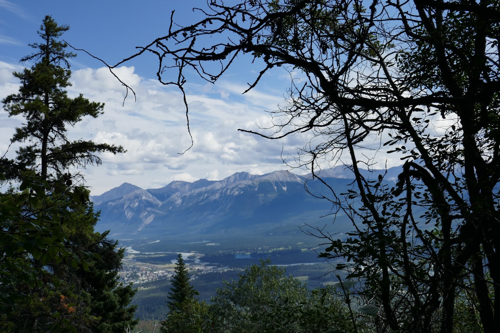
Eventually, the trees started breaking for intermittent views. (Jasper town)
It ended up being a great hike.  So,  in the hopes that someone else may find this information (what I would have liked to know ahead of time) useful, here's my public service hike report.
The second-third of the hike was more or less like this -- mostly shaded.

Apparently, a woman died hiking this trail in May of 2010 -- but that was due to an avalanche while she was off trail, which wasn't an issue for us since there was no snow on the mountain in early August.  But, despite being close to town and supported by the SkyTram at the top, this hike is, as the link notes, a back-country trail, and all of your standard preparedness recommendations should be followed.

Failed timer-shot at the rock flow field.
The trailhead (no bathrooms) is at the P14 area marked on this map.  The short road up to the trailhead off the main SkyTram road is marked with a green hiker sign, and is dirt and gravel for less than 250 meters around the curve.

We headed out at around 10:45 AM and it was 59F.  The first 2/3 were more or less covered, but the last 1/3 was fully exposed, and possibly took 50% of the time due to the elevation, exposed sun, and climb.  Our data claimed 4.2+ miles with 3,350+ ft of elevation gain.  Much less than was claimed in the literature, but we had two GPS synched devices, so, take that for what it's worth.

It felt like there were flat parts and then hard climbs... but the data says otherwise...
Apparently, despite our assumption that there were flats and hard climbs interspersed, it was mainly all a climb.  And, yet, we recommend it.

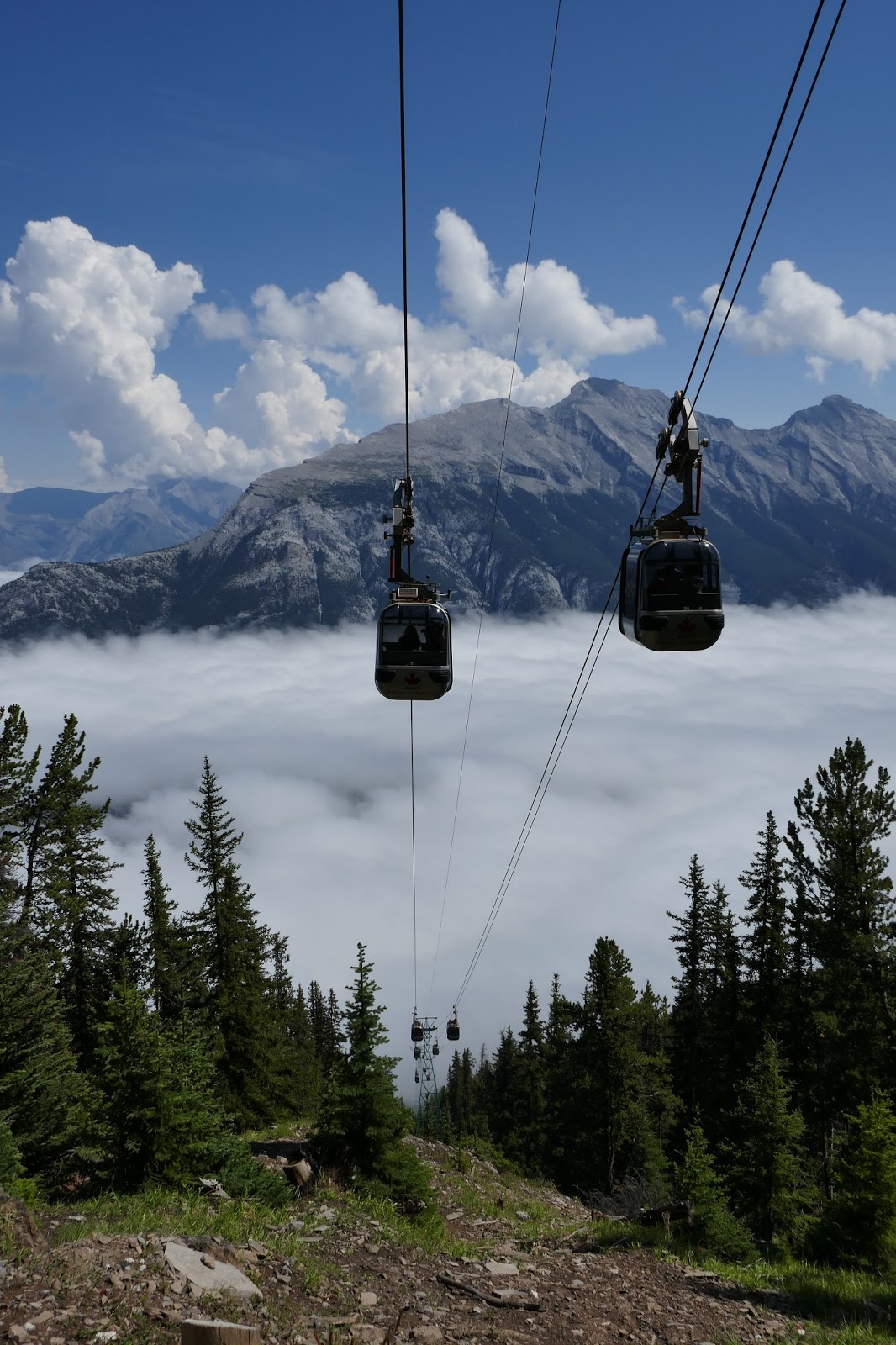
If you take the SkyTram down (1/2 price), you'll arrive back in the parking lot for the tram and will have about 1 mile of hiking back down the road and up the gravel to the parking lot.  We heard that you could cut through the Hostel (off the main road) and it would be easier, but we heard it afterwards, so we can't comment one way or the other.

We clocked 3h01 to the tramhouse/restaurant/water/bathrooms including all stops for pictures, water, etc. and didn't do the climb to the summit because we arrived at the tramhouse hungry.  Also, lunch service was 2+ hours slow.  We were keeping a decent clip for reasonably fit hikers with trekking poles, but I'm short and I tend to slow us down, so take those numbers for what they are worth.  Certainly, we only experienced 1000M+ climb based on our devices' measurements, so the 1200 or 1300 are, in our opinion, an exaggeration with a missed fact (I don't think it was that much elevation even to the Summit), or perhaps, most likely, just a tall tale.

The Summit Hike, available from the tram.  2.8 Km return total.
Overall, this is probably on my top 10 hikes ever.  Very enjoyable to go through 3 different climates and enjoy a solitary hike (we were only passed in the opposite direction by runners and downhill hikers who had obviously taken the tram up).  Enjoy the hike!