January 4, 2014

Closing out AUS and NZ

Day 4 of the Queen Charlotte Track did not go according to plan.  E was limping -- the ice, aspirin, and aspercreme had not been sufficient to stop the knee pain.  Could he have hiked the full 20K on the slippery track after days and nights of rain in time to reach the boat cut off at 4 PM?  Probably.  Did it makes sense for him to do so?  No.

So, after 0.25 miles up the hill, we agreed to head back down to the resort and take the next boat service back to Picton.

We arrived at Picton in time to re-book ourselves for a night in Marlborough wine country!  Bonus! (Aside: Marlborough looks almost *exactly* like Edna Valley from the golden creased hills to the native plants, to the intermittent deep green trees and vegetation planted by the farmers and the interrupting red barns).


After check-in, we expressed interest in wine-tasting, but we were informed that all of the wine tours for the day had already departed.  We called the shuttle manager for the service we'd used to get from the train station to our hotel, and he assured us we were "good as gold" to get in on his current driver's tour, so long as we didn't mind paying full price for only *4* wineries instead of *6*.

6 Wineries in an afternoon is standard?  Let's be clear.  In the event of alien invasion, we want the Kiwis as our ambassadors.  Yikes!

We had a wonderful abbreviated tour of my favorite any-day drinking wine region (there are other regions I prefer, but they are not affordable enough for me to be super-familiar with all of their offerings -- for no-guilt opening of bottles I know I will enjoy, Marlborough is the winner).

Mmmmmm....delicious.

Jane Hunter is a bad ass lady -- inspirational.

We had the shuttle drop us off in downtown Blenheim and we had a true pub food dinner.  A *MASSIVE* plate of fish and chips (with bonus fried calamari) for me while Nolan had the fillet (pronounced fill-it).

From there, we headed back to our hotel, slept, and then woke late, lazy.  We'd originally hoped that the bad weather would hold so our Picton flight would be re-routed to Blenheim like our flight in, but when I called at 10 AM, I was assured that this was not the case for this day.  So, I headed out for a quick short 2.15 mile run through wine country (we were pressed for time, but how could I resist?).  From there, we checked out, dropped our luggage at the front desk and headed to the cafe across the street for the most languid, decadent brunch feast ever.
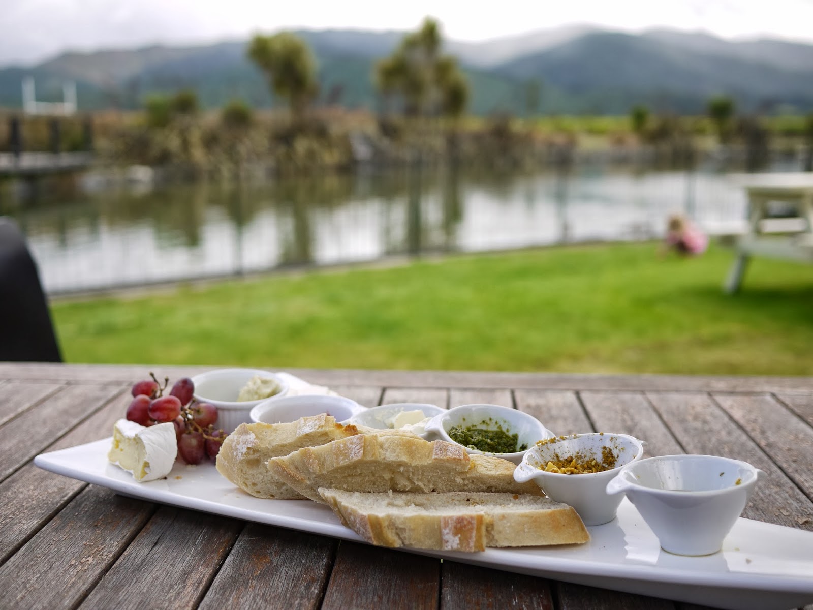


As we sat finishing our wine, a large man sat down and asked for us by name.  Turns out, he was the shuttle driver and since everything in this region is shuttles or private car, we were treated to some standard local culture.  He'd added some folks to his itinerary and if we could hurry it up that would be best for him.  He left us, went across the street, picked up our luggage (again with the complete lack of ID/veracity check) and came back for us and off we set so he would have time to include his additional charges.  As a result of his enthusiasm, we arrived at the super-quaint Picton airport almost an hour early.


Thankfully, the waiting area was essentially a park, so we both read and enjoyed our books.  The weather was getting worse, so we quickly set off as soon as the plane arrived, turning around in this cul-de-sac before heading to the far end for take-off.


We made it.  The weather held and we got to Wellington without too much chaos.  Here's a shot of the South Island behind us as we head to the North Island from the plane:


After that, it was nothing but New Year's and then home.  

It was an awesome trip.  Happy 2014 to all of my loyal readers! (all 14 or so of you!)

January 3, 2014

Queen Charlotte Track: Day 3

Day three was the longest of our itinerary: 25K to and from the water to the highest point of the track and along the ridgeline for a while before heading back down.


Also, it was pouring down rain all night and drizzling off and on when we headed out, so we knew it would be a difficult day.

The exit from Punga Cove resort to the southern portion of the track.
Even with the weather, it was a beautiful and invigorating way to spend the day -- in some ways, I think it may have forced us to go even faster than we otherwise would have because if we slowed down we'd just get even wetter.

How adorable is this photo?

I couldn't understand why E didn't want to wear a hat...
At one look-out point there were distance signs to major international cities.  It was interesting to see that my instincts about global distances aren't very good when you start throwing the southern hemisphere into it.

I'm sure this view is gorgeous when it's not blocked by clouds.
We turned the last major corner to see yet another beautiful view that we agreed would have been breathtakingly perfect under a clear sky but wasn't too bad in this weather either.

Using the "Creative" filter -- essentially hypercolor
Finally, after a long descent that started to take a serious toll on pour E's knees, we made it to the crossroads for that evening's resort.  The weather started to clear and we were treated to great views.

Signs to Picton, Torea Bay (nearest boat dock), and the track

The bay at the Portage Resort, views over the building with our room.
After checking in, it was clear that E needed to ice both his recovering foot *and* his knees.  So, after getting him situated with the ice, I headed down to the bar to grab two beers and walk them back to the room.  I crossed the parking lot just as some of the workers from the hotel who helped check us in were loading a van and they called out to me, jokingly thanking me for bringing them beer at first, and then saying "tell your mate he's got a good one wit' you."  Thanks, Kiwis.  I was happy to deliver the message.

This hotel had been around for quite some time, but it had been recently remodeled.

Mud from the day's efforts.

The view from our balcony.
In keeping with the general theme, we ate dinner as soon as the restaurant opened and fell into a deep sleep early in the evening.  We were fully in vacation mode at this point -- we hadn't had a wi-fi signal or any cell service in 3 days.  It was wonderful.

January 2, 2014

Queen Charlotte Track: Day 2

We slept 13 hours, woke to sore quads (some of those downhills were brutal on the first day), and enjoyed cappuccinos for breakfast.

I was a bit concerned about our luggage getting picked up and delivered to the dock in time for the boat, but E's complete confidence in the resort's ability to execute was correct.  Our luggage headed off in the large cart pulled by a tractor along with several other bags, all labeled for their next destination.

We read a bit in the AM after breakfast so as not to arrive at the next resort before check-in.  Finally, around 11 AM or so, we picked up our packed lunches and headed out.  It was overcast and cool, just like the previous day, and it had rained that night and early AM.

Day 2 of our walk was the easiest day on our schedule, just shy of 8 miles and not much in the way of elevation gain or loss -- yet, again it was more technical than we were expecting due to the mud, puddles and wet conditions of the trail.  We managed to finish in just under 3 hours (not including a 15 minute or so lunch stop). 


Like the day before, we regularly passed other groups of hikers, primarily on the uphills and downhills.  I realized a few things on this trip about my general level of fitness:

i) Trail running is *great* training for hiking.  In general, despite being in my Brooks Ghosts instead of hiking shoes, I found that I knew which foot placements would be good options and which ones would be slippery -- this knowledge let me keep a constant effort going, which helped with keeping a steady pace on the climbs, descents, or amongst roots, rocks, etc.  Also, on the downhills, I adopted a slight bouncing walk that was one gear away from a jog.  I found it to be low effort and *very* efficient -- much easier than trying to brake with my legs and keep to a walking pace.

ii) My general upper body and core strength is much more of an asset while hiking (probably trail running too) than running on the road.  Before E's broken foot, while I could always win on distance, E's comfortable running pace for shorter distances definitely pushed me into a zone where I was working much harder than him.  The opposite is true while hiking -- my comfortable pace both for climbing and descending is in a zone where E is working much harder than me.  I attribute the majority of this to pumping my arms and being able to recruit my core so my legs didn't have to do all of the work.

iii) Knowing how to fuel from running is very helpful when hiking for several hours.  While the needs aren't the same and you can digest much better hiking than you can running, I found it very good and comforting to know when to schedule snacks, meals, and liquids (although it was cool enough and damp enough that my liquid needs weren't that high).

iv)  By day 2, we'd learned that we are what the boat taxi company refers to as "Fast Walkers".  When stops to enjoy the view are included (which makes sense, as you are there to sight-see) we tend to average below 25 minutes per mile.  It's much more variable than that, of course.  A mile with gorgeous views at the top of a long climb would take us closer to 30 minutes, where as a gentle downhill through the bush would be closer to 20 minutes or less.
    
One of many gigantic ferns in the "bush" of the track.
 Day 2's views were equally gorgeous to Day 1's.
The view of Endeavor Bay from the track.
While our tour company put us into 3 resorts along the track selected by them, there are actually multiple campgrounds and 28 different resorts along the way.  This made for interesting interactions with various folks as they hopped on and off the track according to their itineraries.  Often we'd be passed by trail runners (many of whom were in minimalist shoes) going one direction who would then pass us again on their out and back from their resorts.


One of many resorts on the track where we did not stay.

This suspension bridge was so quaint, it felt like it could have been an Eagle Scout project.  If you zoom in, you will see the warning that the max load is 2 Persons. 

A very shaky suspension bridge.
The track guide warned us about these flightless birds that are very accustomed to humans and will beg for food.  They were everywhere on the track, but particularly plentiful at the rest stops, view points, and picnic tables on the track.

Baby of the flightless bird endemic to the area whose name I forget.

Adult of flightless chicken-like beggar bird.
Eventually, after about 2.5 hours of hiking (or "tramping" as the Kiwis call it), we turned the corner and saw our resort on the other side of the bay.

View of Punga Cove (our resort) from across the bay.

Almost there...
We checked in and were absolutely charmed by the view from our A-frame cabin as well as the view from the bar on the dock.

The view from our A-frame cabin.

View from the Punga Cove Bar (on the dock).
The infrastructure on the trail is so good that it was easy to forget just how remote we were.  This hotel key reminded us how much effort was being expended to get everything we were enjoying out to us.  The resorts typically had electricity (generators?) and wells to supply water for bathing, toilets, and cooking, but laundry went to and from Picton by boat each day, as did all consumables and trash.

Rural Bag 408 -- now that's a remote address...

Shortly after locking this door, we fell into deep restful sleep.  I don't know if we actually made it 'til after sunset.  We were exhausted and we knew we had the biggest day of hiking ahead of us the next day.

January 1, 2014

Queen Charlotte Track: Day 1

As part of our Christmas and New Year's vacation, E and I set out to hike the Queen Charlotte Track.

This was my favorite vacation of all I've ever taken.

I can't explain just how relaxing and invigorating (and how much I needed the change of pace) it was -- imagine full days of hiking with your best friend in gorgeous wilderness only to arrive at a resort each night where your luggage has been delivered to your room and you could check-in immediately upon arrival, have a beer, take a hot shower, eat a delicious meal, and fall asleep (often, we struggled to stay awake past 8 PM).

Much of this trip was about re-charging, and we'd done a decent job of trying to erase some of the sleep debt we both had going in before we hit the trail.  Even so, I was unprepared for how well or how much I would sleep when given the gifts of no wi-fi for 4 days straight combined with nature, physical exertion, and an entire economy, functional infrastructure, and worldview of all service professionals built around making the track completely workable for hikers of all abilities.

We flew to Wellington, NZ on Christmas day so that we'd be in NZ and able to get to the start of the adventure on Boxing Day.  The weather had been overcast and stormy until Christmas, but Christmas Day in Wellington was amazingly clear, warm and gorgeous.  We had a wonderful lazy lunch followed by a walk along the water, where I took the most stereotypical Wellington photo ever:

Perfect: Waterfront.  Love Locks.  Large Pacific Islander about to dive into the water.

The next day, we woke at 5:50 AM and took a taxi to the Wellington Airport, where, after absolutely no security or boarding pass or ID check other than asking for our names, we were an hour early at the so-called gate.  Eventually, when they showed up, we learned that the Sounds Air flights from Wellington to Picton (between the North Island and South Island of New Zealand) had been re-routed to Blenheim due to weather.  Conveniently, all passengers on our flight have no trouble fitting into a standard tourist van that shuttled us from Blenheim to the Picton waterfront.

This flight was sold out.

Fancy instrument panels on the Cessna Caravan 208.

Diverted to Marlborough?  As in the region of my favorite Sauvignon Blanc? Hmmm...
At the waterfront, we checked in at Marlborough Sounds Adventure Company (our awesome tour organizing company -- HIGHLY RECOMMENDED), stored the luggage we wouldn't be needing on the track, checked the one bag we'd be asking them to transfer for us, and waited for the water taxi to take us to the far end of the track -- historic Ship Cove.

Picton Harbor

Ship Cove

Getting ready to start the hike.
We toured Ship Cove, and then set out for our first self-guided day, a hike (or "walk") of 8.77 miles that started with a steep climb on clay that had been inundated with rain.  The day was much more technical than we expected due to the wet trail conditions so we spent more time on the trail as "trampers" than expected (almost 4 hours), but the views more than made up for it.  Also, I found my heart rate climbing and my legs burning in ways that made me know this trip was going to be a great contribution to my running fitness as well.

Ship Cove to Furneaux Lodge Garmin Data

Ship's Cove Monument to Captain Cook

We started out at the same time as almost everyone else due to the Ferry drop off.

One of many breathtaking views along the track.

Another one.

Much of the land on the QCT is private land.

Even with the overcast weather, it was, by hour 2, easily the most beautiful hike I've ever done.

We encountered another hiking couple at this viewpoint so we took each others' photos.

The views just weren't getting old.

Even when you couldn't see the sounds, it was beautiful.

E says, "The Tasman Sea isn't as cold as the Pacific Ocean at home."

Bridge to our unit at Furneaux Lodge.

Furneaux Lodge -- private rooms, hot showers, hot meals, and a full bar.  So much better than camping.

Site of post-hike-beers-on-tap and pre-day-2 Cappuccinos.